
My Beloved Creek
On Friday, the 11th of July, I found myself at the very edge of Queens in a very special place. At the end of Vernon Boulevard in LIC, where the old Vernon Avenue Bridge and the Newtown Creek Towing Company were found, is a facility which is engaged in the hands-on work of the Superfund process….

On Friday, the 11th of July, I found myself at the very edge of Queens in a very special place. At the end of Vernon Boulevard in LIC, where the old Vernon Avenue Bridge and the Newtown Creek Towing Company were found, is a facility which is engaged in the hands-on work of the Superfund process. The Anchor QEA company operates out of here, carrying out the collection of samples and scientific tests which will determine the exact nature of what’s wrong with Newtown Creek. These samples and tests are overseen and directed by the Federal Environmental Protection Agency, and is an effort conducted by the so-called “Potentially Responsible Parties” (PRPs).
These “Potentially Responsible Parties” have organized themselves together as the Newtown Creek Group, and they invited a small group of community members and representatives to their LIC facility to describe what they actually do at the Vernon street end and discuss the future of Newtown Creek.
More after the jump…

Inside the building on Vernon, the areas demarcated by the safety tape and traffic cones were forbidden to our party, and were described to us as the “hot zone.” The plastic pans on the floor were filled with bleach, and scientific equipment was everywhere you looked. This is where the actual samples collected from Newtown Creek are processed, some of which contain pretty toxic material. The bleach is there so you can walk through it while leaving the hot zone, which guards against tracking it out.
The Newtown Creek Community Advisory Group or “CAG” (I’m a member) is another organ of the Superfund process – a citizen’s committee which provides the EPA with local input. The Newtown Creek Group had specifically invited the CAG Steering Committee to their LIC location, but I managed to get myself (and Q’stoner) invited along as well.
From newtowncreekcag.wordpress.com:
The CAG is designed to serve as an ongoing vehicle for information-sharing, discussion, and, where possible, consensus-building regarding decision-making related to the Newtown Creek Superfund Site. Its members represent a diverse cross-section of key stakeholder interests, including affected property owners, concerned residents, local governments, community groups, environmental groups, health experts, the business community, and others as appropriate. Requirements and responsibilities for CAG members are described in the CAG’s Operating Procedures, posted in the Resources tab. The Newtown Creek CAG is led by two co-chairs and a steering committee.

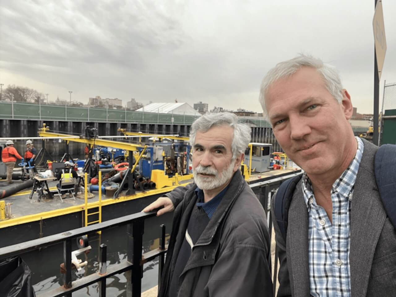
One of the field scientists from Anchor QEA we met was Senior Geologist Nik Bacher, who presented a short tour of the facility and described the use and purpose of various pieces of equipment which the building was filled with. The device pictured above is an isolation chamber which produces an inert nitrogen atmosphere within it, allowing biologically active materials to be safely manipulated via the sci-fi, movie-style glove holes.
From EPA.gov:
In September 2010, Newtown Creek was listed as a Superfund Site on the National Priorities List. EPA signed an Administrative Order on Consent (AOC) with six Potentially Responsible Parties (PRPs) on July 7, 2011. The AOC finalized the Remedial Investigation/Feasibility Study (RI/FS) process, to characterize contamination at the creek, with EPA oversight.
The Remedial Investigation (RI) for the Newtown Creek Superfund site is currently ongoing. Field work is being conducted for a multi-year, multi-phase RI. The Phase 1 RI field investigation began in February 2012 and was completed in March 2013. Phase1 field investigation activities included: a shoreline assessment; creek-bed surveys (bathymetric, magnetic, and side-scan sonar); fish, ecological, and benthic community surveys; surface and subsurface (coring) sediment sampling; air sampling; and monthly surface water sampling.

A significant part of the work that is being done along the Creek involves the collection of sediment cores. Specialized maritime equipment is brought in, which the field team uses to bring up fifteen foot long cylinders of the material which is colloquially referred to as “Black Mayonnaise.” The removal of this sediment will be one of the primary goals of the Superfund process.
From newtowncreek.info:
Phase 1 field activities began in November 2011 and were completed in March 2013. As part of these activities, sampling vessels and field crews were on the creek performing the planned water, sediment, and air sampling. During this extremely intensive effort, approximately 35,000 samples from about 300 stations, were sent to laboratories for chemical analyses. The Phase I data analysis began in April 2013. The results will be made available by EPA when complete.

“Black Mayonnaise” is an agglutination of everything that has ever fallen or been dumped into the Newtown Creek – coal tar, sewage, petroleum residue etc. Highly toxic, there’s anywhere from 15 to 20 feet of the stuff lining the waterway, and in some places it is actually exposed to the air at low tide. The exact composition of this material will determine the steps needed to clean it up.
From habitatmap.org:
Newtown Creek is an estuarine waterbody that forms a portion of the boundary between the boroughs of Brooklyn and Queens in New York City. The site definition includes all the waters, shoreline, channel, tidal-affected zones, and sediments of Newtown Creek, and its tributaries (natural, created, and controlled), from its headwaters to its confluence with the East River. Tributaries include Whale Creek (and the Whale Creek Overflow Canal), Dutch Kills, Maspeth Creek, East Branch, and the English Kills. SITE FEATURES: The entire creek system extends approximately 3.8 miles from the English Kills to the East River. A substantial portion of the creek is contained by bulkheads or riprap and its width averages 200-300 feet. Average depth in the navigable channels is 20 feet below mean low water level. Total surface area of the creek is approximately 170 acres.

The fifteen foot long cores which are collected in the field are frozen, and then cut into five foot long segments for analysis. This particular section shows the boundary layer between the industrial sediments (the black stuff at top) and the native mud (the brown striated layer). That’s the pre colonial and agricultural 17th century in brown and gray, and the age of coal and oil in the 19th and 20th in black.

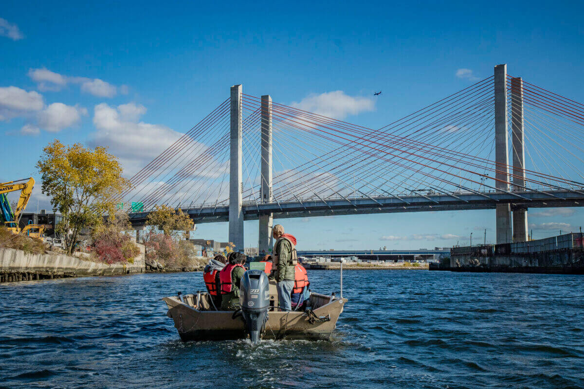
After the description of the testing and collection facility, the Newtown Creek Group representatives handed out life jackets and discussed boat safety, and we headed over to the temporary floating dock they use. A small workboat was waiting for the party of CAG members, which would carry us up the Newtown Creek.

This is Senior Managing Scientist Tim Johnson, from Anchor QEA. He was our excursion leader, and presented the CAG members a series of questions about the future. The boat trip was meant to illustrate and describe some of the testing that his team has accomplished here, and to allow the CAG some input on the recommendations that Anchor QEA and the Newtown Creek Group will submit to the EPA regarding the remediation effort.
From anchorqea.com:
One look at the location of our offices and it’s easy to spot the trend: our company is focused on the waterfront. Oceans, gulfs, bays, rivers, lakes, streams and wetlands, are where you will find us working on planning, cleanup, development, and restoration projects.

Pictured above is Amanda Shellenberger, another Senior Managing Scientist from the Anchor QEA team whom Mr. Johnson described as the “go-to” source for specific information on their efforts. The first location which we visited was at the mouth of Newtown Creek at the East River, with Hunters Point in LIC to the north and Greenpoint in Brooklyn to the south. Real estate development plans on both sides of the creek include parks and green space wrapping around the shoreline. That’s in the future, of course.

Newtown Creek is still a busy industrial waterway, as was tangibly demonstrated when a Donjon Towing Company tugboat, bearing two barges of scrap metal (likely coming from SimsMetal), neared us. It was the Thomas D. Witte tug, for any who might wonder. The Creek is a “SMIA,” a Significant Maritime and Industrial Area, and the Coast Guard calls it “part of America’s Maritime Superhighway.”
From newtowncreekalliance.org:
Newtown Creek was designated a Significant Maritime and Industrial Area (SMIA) in the NYC Department of City Planning ‘s 1992 Comprehensive Waterfront Plan for its characteristic clusters of industrial businesses and water-dependent uses. In the 2010 update of this plan, Vision 2020, Newtown Creek maintains its place as New York City’s largest SMIA in terms of both land area and employment. After losing half its jobs from 1992 to 2008, the number of jobs in Newtown Creek SMIA grew by nearly 1,400 (totaling 15,000 jobs) from 2000 to 2008.

After the tug passed, Mr. Johnson’s crew brought us to the mouth of Dutch Kills, which is just under a mile back from the East River. Also pictured is Lupe Todd, who works for the Newtown Creek Group’s PR firm Connective Strategies. LIC’s Dutch Kills tributary has been featured at Q’stoner before – aerially here, the Hunters Point Avenue Bridge here, the Empty Corridor under the Long Island Expressway here, and the Borden Avenue Bridge was discussed here.
The conversation centered around suggestions for environmental and wetland restoration which was first proposed by the Brownfield Opportunity Areas report compiled by Newtown Creek Alliance, Riverkeeper, and the GMDC.

Part of the discussion at Dutch Kills centered around the requests for wetland restoration and green infrastructure contained in the Brownfield Opportunity Area report on Newtown Creek. Anchor QEA’s team members confirmed that Dutch Kills, due to its relative isolation from the rest of the waterway (the movable rail bridges at its mouth are no longer “movable” inasmuch as their mechanisms no longer work) and the lack of maritime customers back there, is a prime candidate for environmental restoration and so called “green infrastructure.”
This is LIC’s own waterway, which once flowed through what is now the Sunnyside Yard and the foot of 29th Street at Queens Plaza nearby the Queensboro Bridge. It’s why the neighborhood in that part of town is called “Dutch Kills,” after all.
Just to the east of Dutch Kills is a huge recycling facility operated by the SimsMetal Corporation, which was described in this 2013 Q’stoner post.

Our next destination was going to take us through what I describe as “the Newtown Creek Petroleum District.” One of the birthplaces, or at least the nursery school, of the American Oil Industry, the name of the game at Newtown Creek in the 21st century is not refining – as it once was – it’s distribution. Maritime barges bring in bulk heating oil and gasoline, which is then distributed to customers by truck. The only refining going on today is actually being done by an oil and biofuel company – Metro – found on the Brooklyn side of the Greenpoint Avenue Bridge, which was recently acquired by former Mayoral candidate John Catsimitidis.
From metroenergy.com:
In March 2013, United Metro purchased the Greenpoint Terminal, the Calverton Terminal, and other assets of Metro Fuel Oil, Metro Terminals, and their affiliated companies, preserving the jobs of over 130 workers together with their proud tradition of family-oriented heating oil service. With the financial strength and strategic assets of the Red Apple Group and over 70 years of tradition in the fuels business, United Metro is uniquely positioned to deliver excellent 24 x 7 service and value to its customers as one of the largest retail residential and wholesale energy providers in the New York Metropolitan Area.

Passing through DUGABO – Down Under the Greenpoint Avenue Bridge Onramp – the former site of the Van Iderstine rendering company comes into view in Blissville on the Queens side. Calvary Cemetery is just a block back from the bridge, and the LIRR freight and passenger tracks are found between it and the Newtown Creek.

On the Brooklyn side, the BP Amoco tanks in Greenpoint. This was once home to the Standard Oil Sone and Fleming refinery, which experienced a catastrophic series of fires over the years. The Standard Oil works stretched along both sides of the Creek, providing tens of thousands of jobs over a long occupancy, but several total loss fires and generations of leaky pipelines or sloppy practices resulted in millions of gallons of petroleum being lost into the ground.
This is more or less the dead bang center of what was originally called the Newtown Creek Spill, but which is referred to as the Greenpoint Spill by those of us in the know. The former implies that there’s only one oil spill found at Newtown Creek, which is what the mission of the Anchor QEA folks is actually all about – getting a handle on both the big and small picture along the 3.8 miles of bulkhead.
The oil spill(s) is a whole separate thing from the Superfund, incidentally.
From ag.ny.gov:
NEW YORK, N.Y. (November 17, 2010) – Attorney General Andrew M. Cuomo today announced a settlement that commits ExxonMobil Corporation (NYSE: XOM) (“ExxonMobil”) to perform a full clean up of its oil spill as well as any related environmental contamination in Greenpoint, Brooklyn. The massive spill has been a source of contamination in the Greenpoint community for decades.
The settlement was filed today in Federal Court in the Eastern District and requires ExxonMobil to pay for the costs of cleaning up the Greenpoint oil spill.

On the Blissville side, directly across from the so called “Peerless site,” oil seeps from the former bulkheads of Charles Pratt’s Queens County Oil Works. The Blissville site also sits on the footprint of the very first large scale kerosene factory in North America- Abramham Gesner’s North American Kerosene Gas Light Company.
From epa.gov:
By 1870 more than 50 refineries were located along the banks of Newtown Creek. This tidal area of salt marshes along the creek was reportedly severely impacted and saturated by the waste discharges of the industries and refineries in the area in the late 1800s.
In 1892, the majority of the area refineries were purchased and consolidated into the Standard Oil Trust. Following the breakup of the Trust in 1911, ownership of the refinery property in Greenpoint reverted to the Standard Oil Company of New York (SOCONY), and these operations became the SOCONY Brooklyn Refinery. SOCONY later became Mobil Oil Corporation, which later became Exxon/Mobil Corporation.

Another Queens tributary discussed in the BOA report which the Anchor QEA scientists were excited about as a wetlands restoration candidate, was Maspeth Creek. CAG members, including myself, pointed out the diversity of bird life observed at this tributary and the self seeded shoreline vegetation. Unfortunately, the large CSO at the end of Maspeth Creek continues to spew pollution during rain events, building the sediment bed of Black Mayonnaise which lends this area its certain perfume.

That’s Lupe Todd on the right, with LaGuardia Community College’s Dr. Sarah Durand at center, and Kosciuszcko Bridge Community Liaison (and community activist) Christine Holawacz at the left.

One thing about the far reaches of my beloved Newtown Creek – and we weren’t too far from the Maspeth Plank Road or the Grand Street Bridge when this shot of the National Grid properties in Brooklyn was captured – is that it never disappoints. This is one of the most interesting places in the entire megalopolis to me – with its wide open sight lines, naked infrastructure, and iconic back drops.

English Kills, another Newtown Creek tributary which exists entirely within Brooklyn, is actually the worst-off section of the waterway from an environmental point of view. Despite the loathsome chemicals and compounds which are found in the water and sediment here, you regularly spot exotic bird life here. That’s a Snowy Egret, I’m told, but I’ve seen all sorts of interesting birds back here – including a Great Blue Heron or two.

Godzilla isn’t found at Newtown Creek, despite what you’re seeing in the shots above and below. This is the NYC DEP’s aeration system at work. Essentially a gigantic bubble wand for this aquarium, the system pumps air under high pressure into English Kills. The bubbling disturbs the surface which helps to oxygenate the water, and combats the anoxic conditions which plague the tributary and leave it virtually dead during the summer months.
Low oxygen conditions in the water are largely caused by a lack of “flow” and the actions of the Combined Sewer Outfall system which flood the water with oxygen hungry bacteria.

DEP and the state DEC are proposing expanding this system all the way back to the Greenpoint Avenue Bridge, which is controversial amongst the activist community and is a topic about about which Riverkeeper – in particular – has voiced serious concerns about the system’s expansion.
From riverkeeper.org:
For several years, the New York City Department of Environmental Protection (DEP) has been aerating English Kills, the most polluted section of Newtown Creek, in order to increase oxygen levels to acceptable standards, which is crucial to a water body’s health. Soon, the city plans to expand this process throughout the rest of the creek.
A new study published in Environmental Science and Technology, shows the city’s aeration technique is releasing bacteria and other particles into the air above Newtown Creek and found bacteria types in the air consistent with the sewage and oil pollution in the creek. The study is one of the first to establish a link between water pollution and air-quality, raising new questions about the health risks posed by dirty water. The study of airborne bacteria at the site is part of a long-term collaboration between Riverkeeper and scientists at Lamont-Doherty and Queens College to monitor water quality in the Hudson River and its watershed.

My beloved Creek is entering a season of great change, and the sky is literally the limit for what can happen here.
Once upon a time, the industrial Newtown Creek represented nearly two million jobs spread across its vast watershed, and it carried a greater tonnage of cargo than the entire Mississippi River. It’s 3.8 miles long, providing the currently undefended border of Brooklyn and Queens, and sits at the dead bang center of New York City.
What do you want to see happen here on Newtown Creek? The Federal EPA, the City of New York, even the so called “Potentially Responsible Parties” or Newtown Creek Group are requesting your input. What do you say, Maspeth – and Blissville – and Ridgewood – and Sunnyside – and LIC?
The Newtown Creek CAG summer meeting will be coming up soon.
Newtown Creek Alliance Historian Mitch Waxman lives in Astoria and blogs at Newtown Pentacle.


Once again, excellent work. Fascinating post.
Incredible post, and thank you.
The aeration study is slightly disturbing. Curious to know what geographical area (i.e. how far do the bacteria travel) is potentially affected by the aeration. Then an informed decision can be made.
– Chris